149 HALSTED DRIVE
Owner Information
KENNEDY MICHAEL J & MARY E
149 HALSTED DRIVE
HINGHAM, MA 02043


Property Details
149 HALSTED DRIVE is classified as a Residential Condominium (Condominium).
The primary structure on this property was built in 2012. There are 2,884ft2 of built area within this property. There is 2,464ft2 of residential/living space within this property. This property is listed as having 6 rooms.
149 HALSTED DRIVE is valued at $1,373,500. The land is valued at $0 and the structures are valued at $1,373,500.
The most recent deed for 149 HALSTED DRIVE is recorded at the local registrar in Book 43851, Page 0260. 149 HALSTED DRIVE was last sold on Friday, November 22, 2013 for $959,000.
Assessment data from fiscal year 2022.
Flood Data
This property is partially within the VE Zone (coastal flooding with wave action). Approximately 1.02 acres (4.68%) of the property is within this zone.
The base flood elevation for this flood zone is 13 feet.
This information is sourced from the FEMA National Flood Hazard Layer. See our full disclamer.
Broadband Internet Providers
| Provider | Type | Bandwidth (mbps) | |
|---|---|---|---|
| Verizon New England Inc. | Fiber | 940 | 880 |
| GCI Communication Corp. | Satellite | 0 | 0 |
| MCI | Copper Wire | 0 | 0 |
| Viasat Inc | Satellite | 100 | 3 |
| Verizon New England Inc. | DSL | 1 | 0 |
| VSAT Systems, LLC. | Satellite | 2 | 1 |
| HughesNet | Satellite | 25 | 3 |
| Comcast | Cable | 1000 | 35 |
| T-Mobile | Fixed Wireless | 25 | 3 |
Broadband service provider data from December 2020.
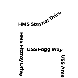
Adjacent Properties
- 152 SHIPYARD DRIVE
Apt Over 8 owned by AVALON SHIPYARD LLC - 23 BRADLEY WOODS DR
Single Family Residential owned by SAN ANTONIO CHRISTINE - 0 BRADLEY WOODS DR
Utility Authority - Electric, Light, Sewer, Water owned by TOWN OF HINGHAM-SEWER - 24 BRADLEY WOODS DR
Single Family Residential owned by LEAKE GABRIEL - 22 BRADLEY WOODS DR
Single Family Residential owned by MANNION JOHN J & JANICE L - 24 SYCAMORE LANE
Single Family Residential owned by SOOD ABHINAV D & PINI JOANNA M - 44 SHIPYARD DRIVE
Conservation owned by DEPARTMENT OF CONSERVATION & RECREATION - 30 SHIPYARD DRIVE
Conservation owned by DEPARTMENT OF CONSERVATION - 0 SHIPYARD DRIVE
Undevelopable Commercial Land owned by SEA CHAIN MARINA LLC - 0 WOMPATUCK ROAD
Conservation owned by TOWN OF HINGHAM CONSERVATION - 0 OFF IVY WAY
Rec Active owned by TOWN OF HINGHAM REC COMM - 15 CONDITO ROAD
Other Congregate Housing (includes non-transient shared living arrangements) owned by BMSH II HINGHAM MA LLC - 3 JUNIPER ROAD
Single Family Residential owned by ODONNELL JOHN P & KIRSTEN E ODONNELL - 150 AMESBURY DRIVE
Developable Commercial Land owned by HEWITTS COVE MARINA LLC - 9 JUNIPER ROAD
Single Family Residential owned by ATWOOD JUSTIN & EFFLER SUSAN - 7 JUNIPER ROAD
Single Family Residential owned by HOLMQUEST CHARLES KIRK & SUZANNE - 5 JUNIPER ROAD
Single Family Residential owned by BALLOU DENNIS J